A survey flight that produces an unusable dataset usually failed at the planning stage, not the processing stage. Three decisions carry most of the weight, and they are made before the aircraft leaves the ground.
Ground sample distance sets the altitude
What it is. How much ground each pixel covers. Two centimetres per pixel, five centimetres, whatever the job needs.
What it depends on. Flight altitude, lens focal length and sensor pixel size. With a given aircraft only altitude is variable, so the required resolution fixes the altitude.
Choosing the number. General site mapping tolerates a coarse figure. Measuring construction detail or counting small objects needs a fine one. Ask what the smallest feature that must be identifiable is, then work back.
The trade-off. Flying lower means finer pixels, less ground covered per image, more flight lines, more batteries and far more images to process. Processing time rises faster than image count.
The common mistake. Flying lower than needed on the assumption that finer is always better. The result is a survey that takes four times as long and delivers nothing more useful.
Check the legal ceiling. The altitude your calculation produces has to sit inside whatever height limit applies at that location.
Overlap and why it is set high
Why overlap exists. Photogrammetry software calculates the three-dimensional position of a point by seeing it in several images taken from different positions. No repeated views, no reconstruction.
Forward overlap. Between consecutive images along a flight line. Typically set between seventy and eighty per cent.
Side overlap. Between adjacent flight lines. Typically sixty to seventy per cent.
When to raise it. Dense vegetation, urban areas with tall buildings, and low-texture surfaces such as sand, water or uniform roofing. Eighty-five per cent or more is reasonable in those conditions.
What high overlap costs. More images, longer flights, and disproportionately longer processing.
What low overlap costs. Reconstruction failures, holes in the model, and distortion at the edges of gaps.
The practical rule. Err high. Reflying costs far more than an extra hour of processing.
Cross flights. A second pass at ninety degrees to the first noticeably improves reconstruction of vertical structures and complex terrain.
Ground control
Why it matters. Standard satellite positioning on the aircraft carries several metres of error. Anything requiring better than that needs surveyed reference points.
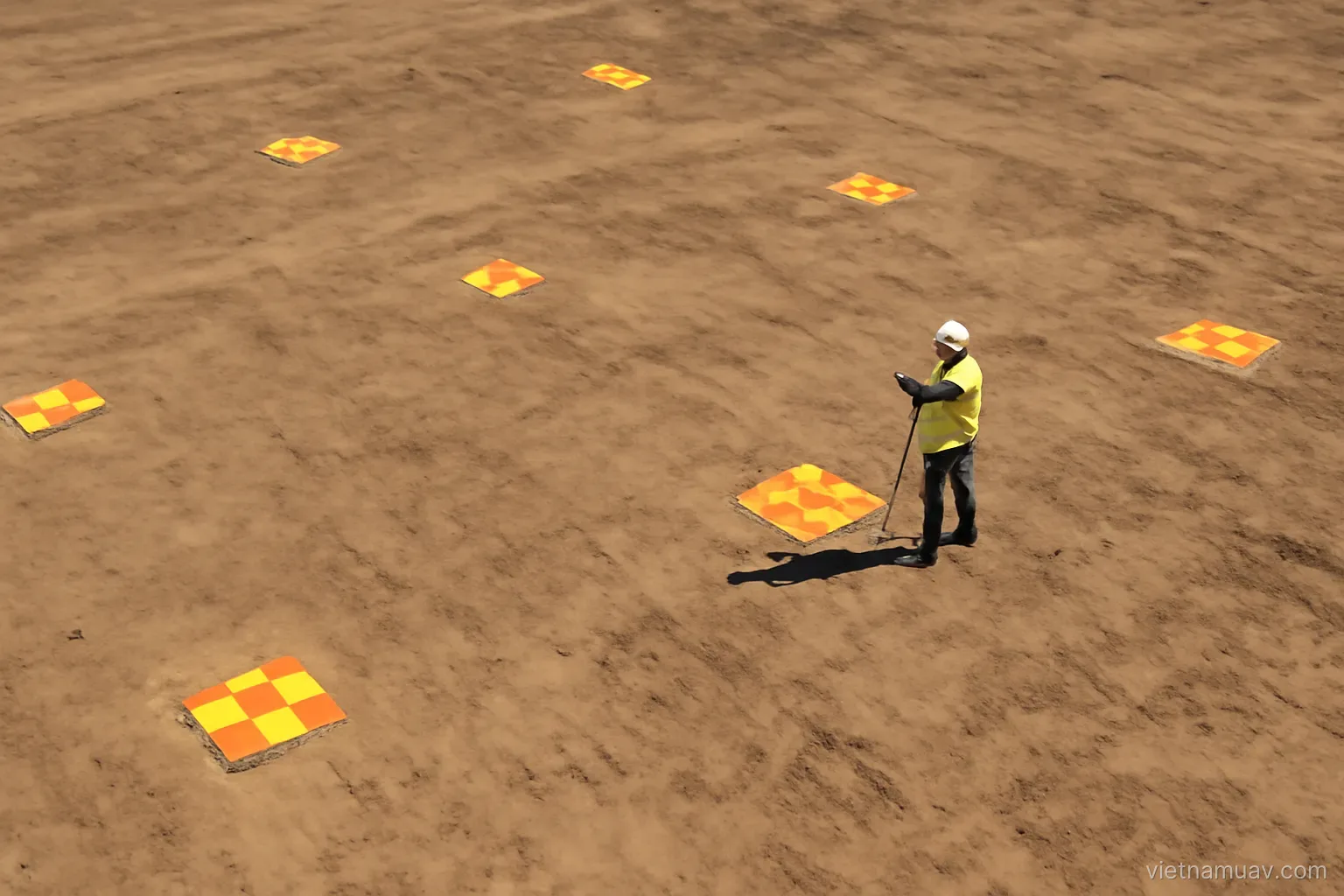
How many. Five is the practical minimum — four corners and one centre. Larger sites need more, distributed evenly.
Distribution matters more than count. Points clustered in one area leave the rest of the site unconstrained. Vary elevation too if the terrain does.
Marking them. High-contrast targets, large enough to identify clearly at the flight altitude. Size follows from the ground sample distance.
Surveying them. With high-precision satellite equipment or a total station. The accuracy of the control points caps the accuracy of the entire deliverable.
Check points. Survey several additional points and deliberately leave them out of processing. They are the only honest measure of final accuracy.
When control points can be skipped. When the aircraft carries high-precision positioning. Keep a few check points regardless — trusting the system without verification is how systematic errors go unnoticed.
Conditions that affect the result
Even light is what you want. Thin uniform cloud is better than bright sun, because it removes hard shadows without removing detail.
Avoid low sun. Early morning and late afternoon cast long shadows that hide ground detail and complicate image matching.
Avoid broken cloud. Light changing between images produces a mosaic with visible bright and dark patches. This is the worst condition for survey work.
Wind. Affects stability, flight time and image tilt. A drone holding position against wind sits at an angle, and so does the camera.
Vegetation movement. Trees and crops moving in wind are the hardest surfaces to reconstruct. Calm conditions matter more over vegetation than over bare ground.
Humidity and condensation. Moisture forming on the lens when the aircraft climbs into cooler air produces soft images with no obvious cause.
Record the conditions. Time, weather, wind. When results disappoint, this is the first thing worth checking.
Verify before leaving site
Do not pack up immediately. Reflying while still on site costs a fraction of returning another day.
Count the images. Against the plan. A shortfall means a section was not captured.
Check sharpness. Open several images at full magnification. Motion blur from wind or a slow shutter is common and fatal.
Check exposure. Nothing badly clipped in highlights or blocked in shadows.
Check the control targets. Every one should be clearly visible in several images.
Check coverage at the edges. Boundaries are where gaps appear.
Check geotags. Every image should carry a position.
Back up before leaving. To at least one additional device. A lost card is a lost survey, and cards are lost more often than anyone expects.
Frequently asked questions
Which parameter should be decided first?
Ground sample distance — how much ground each pixel covers. It fixes the flight altitude, which then determines coverage per image, number of flight lines and total image count.
When should image overlap be increased?
Over dense vegetation, urban areas with tall buildings, and low-texture surfaces such as sand, water or uniform roofing. Err high, because reflying costs far more than extra processing.
How many ground control points are needed?
Five is the practical minimum — four corners and one centre — distributed evenly and varying in elevation if the terrain does. Survey additional check points and leave them out of processing.
What is the worst lighting condition for survey work?
Broken cloud. Light changing between images produces a mosaic with visible bright and dark patches. Thin uniform cloud is the best condition.
More in Flight data processing and Flight planning.