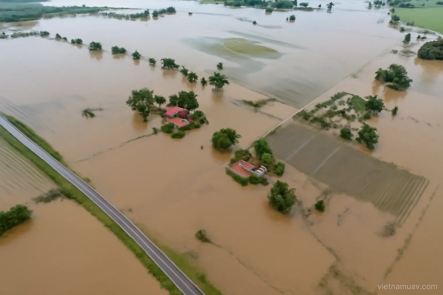
In the first hours after a flood or landslide, the scarcest commodity is information about what has actually happened. Drones fill that gap faster than any other available means.
The first hours
What command needs. Which areas are affected, how badly, which roads remain passable, whether anyone is stranded.
What a drone delivers. Answers within tens of minutes, while ground teams are still trying to reach the area.
Speed over polish. At this stage raw imagery relayed live is worth more than a finished map three days later.
Fly the road network. Identifying which sections are flooded, washed out or blocked. This drives every decision about getting relief in.
Fly settlements. Counting affected buildings, spotting people on roofs, identifying isolated pockets.
Log coordinates for everything. A list with positions is far more actionable than a verbal description.
Relay live where possible. Command sees it immediately rather than waiting for the aircraft to return.
Prepare in advance. Equipment ready, batteries charged, outline plans for high-risk areas. Preparing after the call comes is too late.
Damage mapping
The second phase. Once the situation stabilises, quantified assessment is needed.
Flood extent. Area, estimated depth from a terrain model, number of households affected.
Landslide mapping. Area, displaced volume, continuing risk.
Before-and-after comparison. If pre-event survey data exists, the comparison is very powerful. This is the argument for surveying high-risk areas during normal conditions.
Building assessment. Destroyed, severely damaged, intact. The basis for allocating relief and compensation.
Infrastructure. Bridges, roads, embankments, canals. The basis for reconstruction planning.
Agricultural loss. Inundated crops, felled orchards, breached aquaculture ponds.
Dated, georeferenced evidence. Important for assistance procedures and insurance.
Repeat at intervals. Floodwater recedes and slopes continue moving. A single survey captures one moment; a series shows whether the situation is stabilising.
Share the data. With authorities and relief organisations. Data retained privately loses most of its value.
Difficult flying conditions
Bad weather is the default. Disasters arrive with rain and wind.
Respect the wind limit. Losing the aircraft mid-response removes the capability entirely.
Rain. Most drones are not water resistant. Flying in rain damages them.
Poor visibility. Fog, rain and smoke affect both flying and data quality.
No power and no signal. Cannot charge, cannot relay, cannot load online maps. Bring portable power and offline mapping.
New obstacles. Fallen trees, downed power lines, collapsed structures. Existing maps are no longer accurate.
Crowded airspace. Rescue helicopters, other aircraft, other drone teams. Coordination is mandatory.
Launch sites. Dry, level ground is hard to find. Carry a landing mat.
Personal safety. Fast water, unstable ground, weakened structures. Do not put yourself at risk to collect data.
Coordination and conduct
Register with the incident command. Freelance flying in a disaster zone interferes with the response and may be prohibited.
Take specific tasking. Which area, looking for what. Unfocused flying produces data nobody uses.
Report in a common format. So information from multiple crews can be combined.
Prioritise life-saving information. Over damage assessment.
Do not circulate sensitive imagery. Casualties, bodies, private property. This is a serious ethical matter and is subject to regulation.
Be careful with media. Shocking imagery spreads quickly and can harm affected families. Hand it to the authorities rather than publishing it.
Prepare before the season. Equipment list, roles, communication plan, agreements with local authorities. Arranging it in advance is what makes a fast response possible.
Exercise with responders. Learn their procedures and their people before an incident, not during one.
Baseline data before the event
The preparation with the highest return.
Survey high-risk areas in normal conditions. With baseline data, post-event comparison produces quantified results immediately.
Which areas to prioritise. Previous landslide sites, flood-prone riverbanks, settlements below slopes, reservoirs and embankments.
Terrain models. The basis for later calculating inundation depth and displaced volume.
Building inventory. Counted and located.
Update annually. For areas changing quickly.
Archive and share. This data belongs to the community. Held on a personal drive, it delivers nothing.
Identify launch sites in advance. High, accessible ground within the risk area. Surveying this beforehand saves valuable time later.
Train local crews. A team already in the area responds far faster than one arriving hours later from elsewhere.
Frequently asked questions
What should be prioritised in the first hours after a disaster?
Speed over polish. Raw imagery relayed live to command is worth more than a finished map three days later, and road network coverage drives every relief decision.
Which preparation delivers the highest return?
Surveying high-risk areas during normal conditions to create baseline data. With it, post-event comparison produces quantified results immediately.
What practical difficulty is most often forgotten?
Loss of power and mobile signal — no charging, no live relay, no online maps. Portable power and offline mapping have to be part of the kit.
What is the ethical rule on imagery from a disaster zone?
Do not circulate sensitive material showing casualties, bodies or private property. Hand it to the authorities rather than publishing it.
More in Flight data processing and Operations and safety.